
ก่อนที่จะไปชมภาพทั้งหมดที่ผมได้รวบรวมมาไว้ที่นี่ ก็อยากจะให้ทราบเจตนาที่แท้จริงของผมเสียก่อน ผมทราบดีว่า การนำเสนอภาพความสูญเสียนั้น ”มันเป็นดาบสองคม” แก่ตัวผู้เขียนเอง ก็เลยต้องมาอธิบายไว้ก่อนเนิ่น ๆ เพื่อที่จะได้ไม่ผิดวัตถุประสงค์ในการสื่อสาร อันดับแรก ผมไม่เคยมีความต้องการที่จะทำร้ายความรู้สึกของใคร แล้วก็ไม่คิดจะตอกย้ำซ้ำเติมความบอบช้ำของประเทศ เพราะผมมีความเคารพรักต่อชาติไทยของเรามาโดยตลอด ผมต้องการเพียงแค่ปลุกสำนึกในความสามัคคี ร่วมมือร่วมใจกัน ช่วยเหลือเกื้อกูลกัน.ในการป้องปรามและการจัดการแก้ไขปัญหา ให้ยุติไปได้ด้วยความรวดเร็วที่สุด.และมีประสิทธิภาพสูงสุด
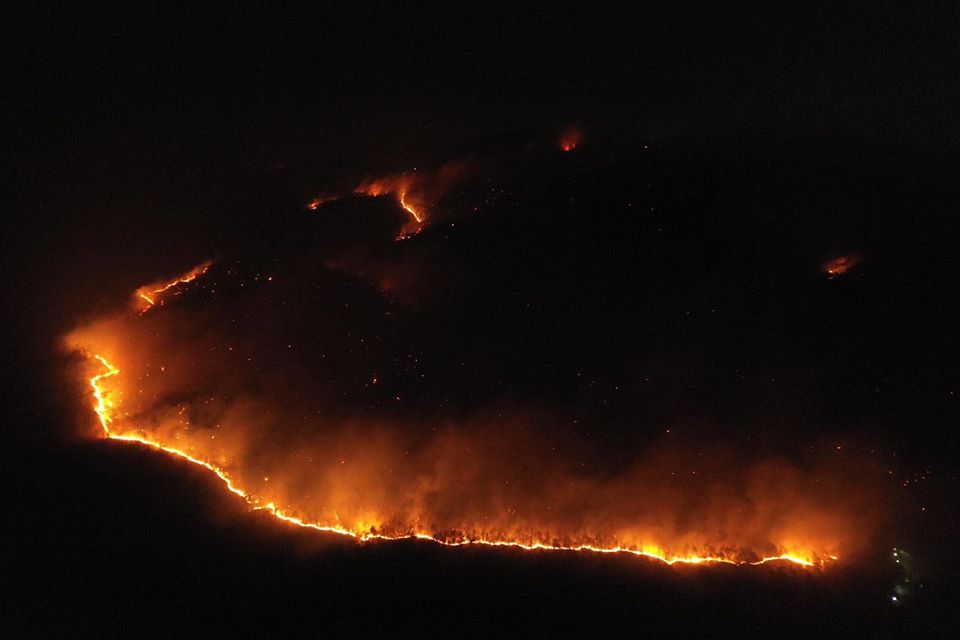
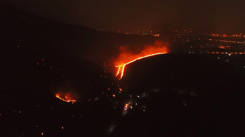
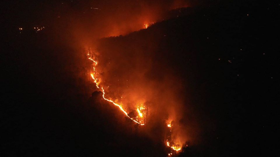
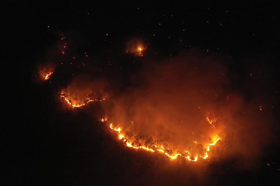
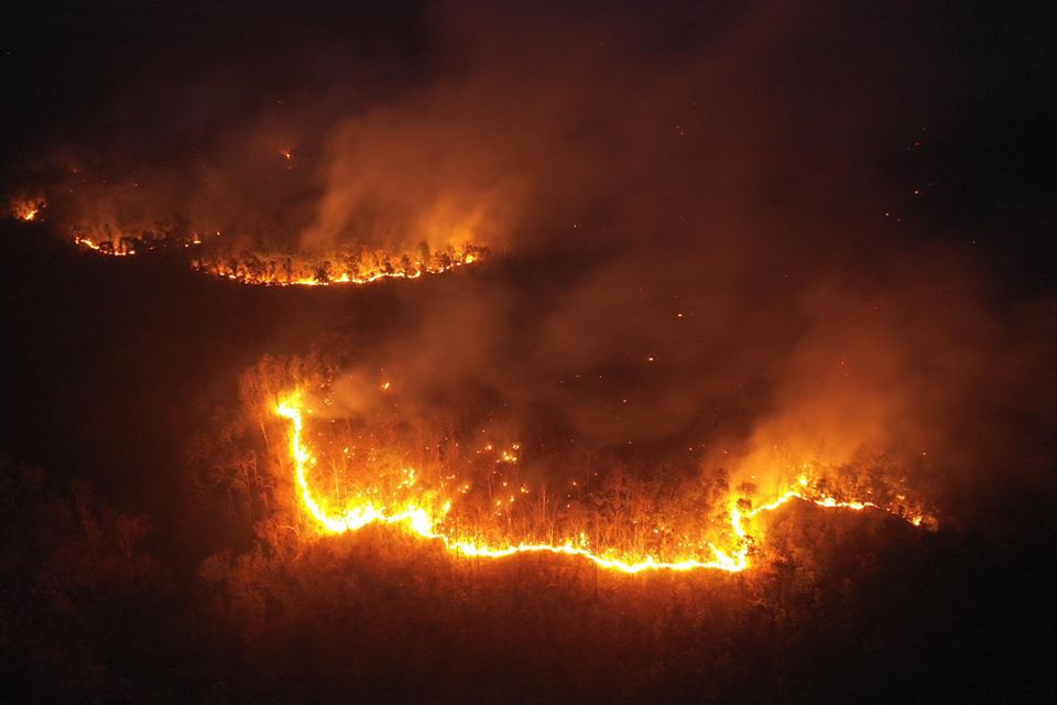
แล้วนี่ก็คือภาพมุมสูงจากทีมโดรนอาสา ที่ได้ทำการบินเข้าไปสำรวจและบันทึกภาพ สถานการณ์ไฟป่า ยังบริเวณหลังวัดป่าธรรมชาติ อ.หางดง จ.เชียงใหม่ เพื่อตรวจสอบดูเส้นทาง ในการวางแผนเพื่อระงับแนวทางของไฟต่อไป ซึ่งได้มีรายงานอย่างต่อเนื่องว่า ไฟยังลุกลาม และ ขยายตัวเป็นวงกว้าง (เมื่อ 25 มีนาคม 2563)
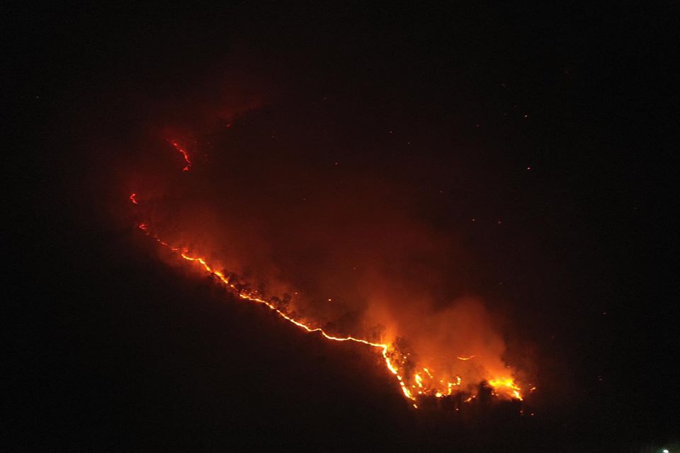
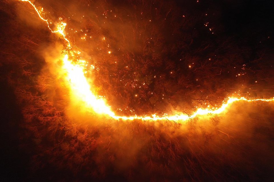
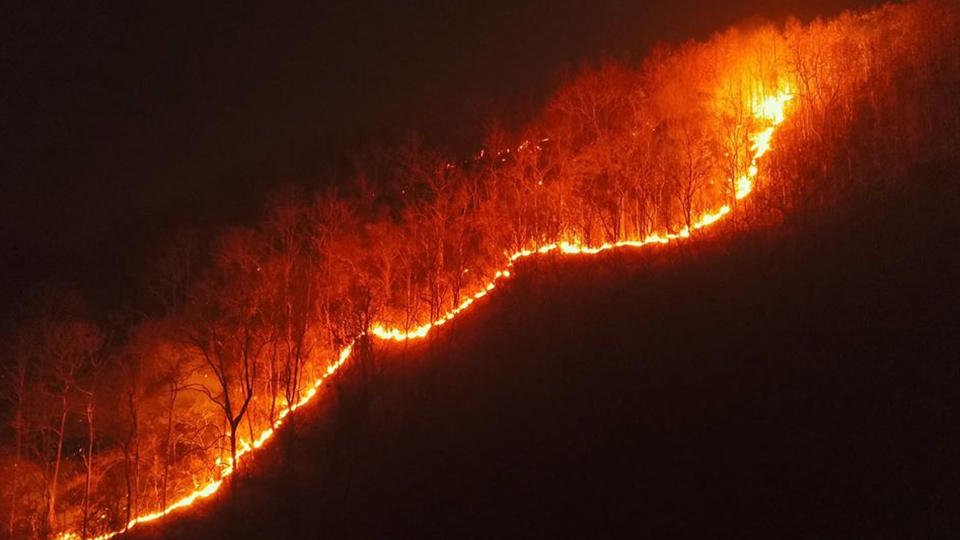
เนื่องจากในพื้นที่ มีใบไม้แห้งเป็นเชื้อเพลิงจำนวนมาก บวกกับลมที่พัดแรง จึงทำให้ไฟลุกลามอย่างรวดเร็ว
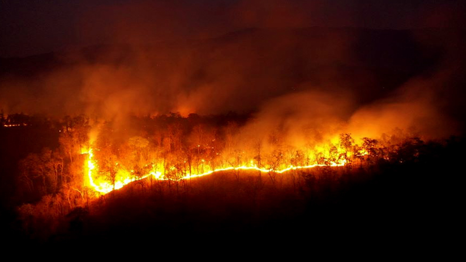
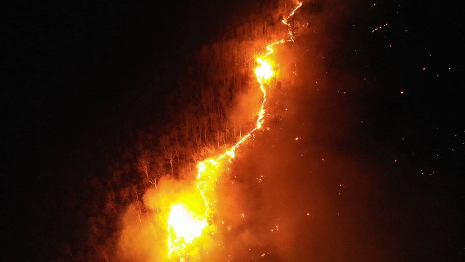
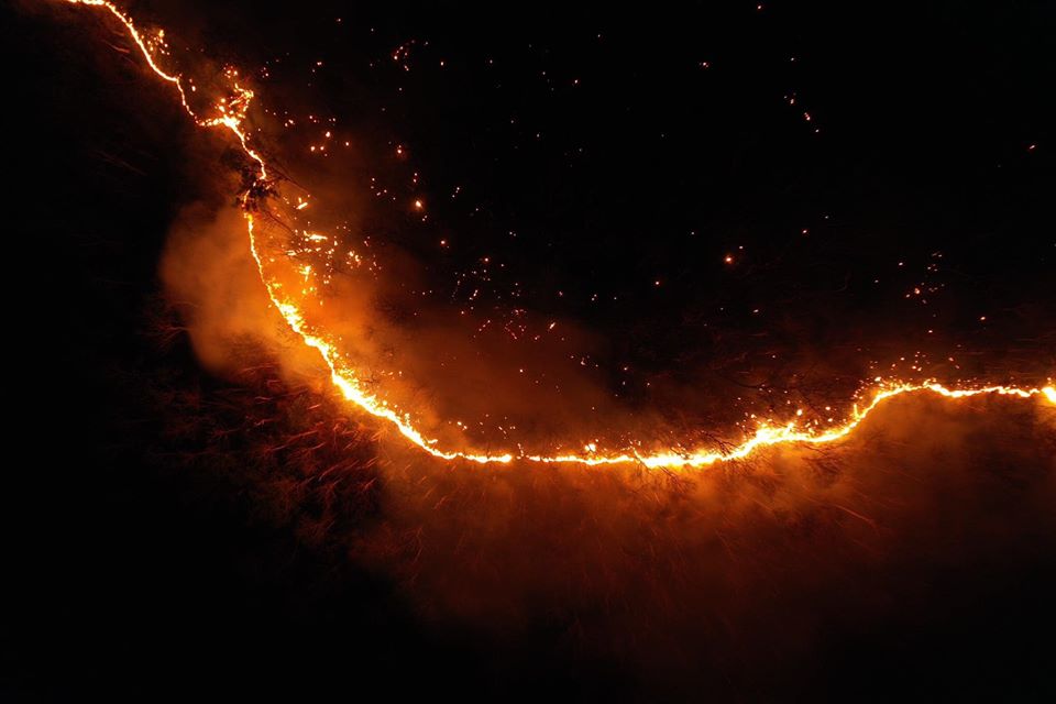
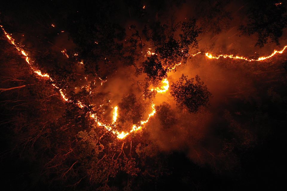
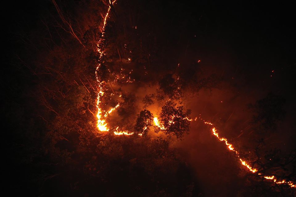
รายงานล่าสุดจากเมื่อวานนี้ (27 มีนาคม 63) เมื่อเวลา 19:40 น. ซึ่งมีการเฝ้าสังเกตุการณ์ใกล้ชิดในพื้นที่ โดย ทีมโดรนอาสา ซึ่งได้บินสำรวจแนวไฟป่าบ้านปง อ.หางดง จ.เชียงใหม่ ที่เพลิงไหม้ลุกลาม และได้ขยายตัวออกเป็นบริเวณกว้างอย่างต่อเนื่อง ที่พิกัด 18°47’28.7″N 98°52’18.6″E จากการตรวจสอบเบื้องต้น พบว่าเป็นแนวไฟลามจากจุดความร้อน (hotspot) เดิม ....ซึ่งนับเป็นวันที่สี่ ที่ยังไม่สามารถควบคุมไฟได้ทั่วทุกจุด
credit >>>>>>>> Environman >>>>>>>>> https://www.facebook.com/environman.th
credit >>>>>> WEVO สื่อสู้ฝุ่น >>>>>> https://www.facebook.com/wevogroup/WEVO
credit >> เทศบาลเมืองแม่เหียะ เชียงใหม่ >> https://www.facebook.com/citymaehia